
Archival Ultra-HD Thematic Maps & Historical Atlas
Authentic, high-resolution digitized cartography of Bangladesh: 1971 Liberation War military fronts, Major James Rennell 1776 survey, Mughal Subah Bangala, 1875 Survey of India, and historic boundaries available in vector SVG, ultra-HD JPG, and museum-grade 300 DPI archival prints.
All Maps Are 100% Free
All 9 ultra-HD archival maps are free to download in high definition
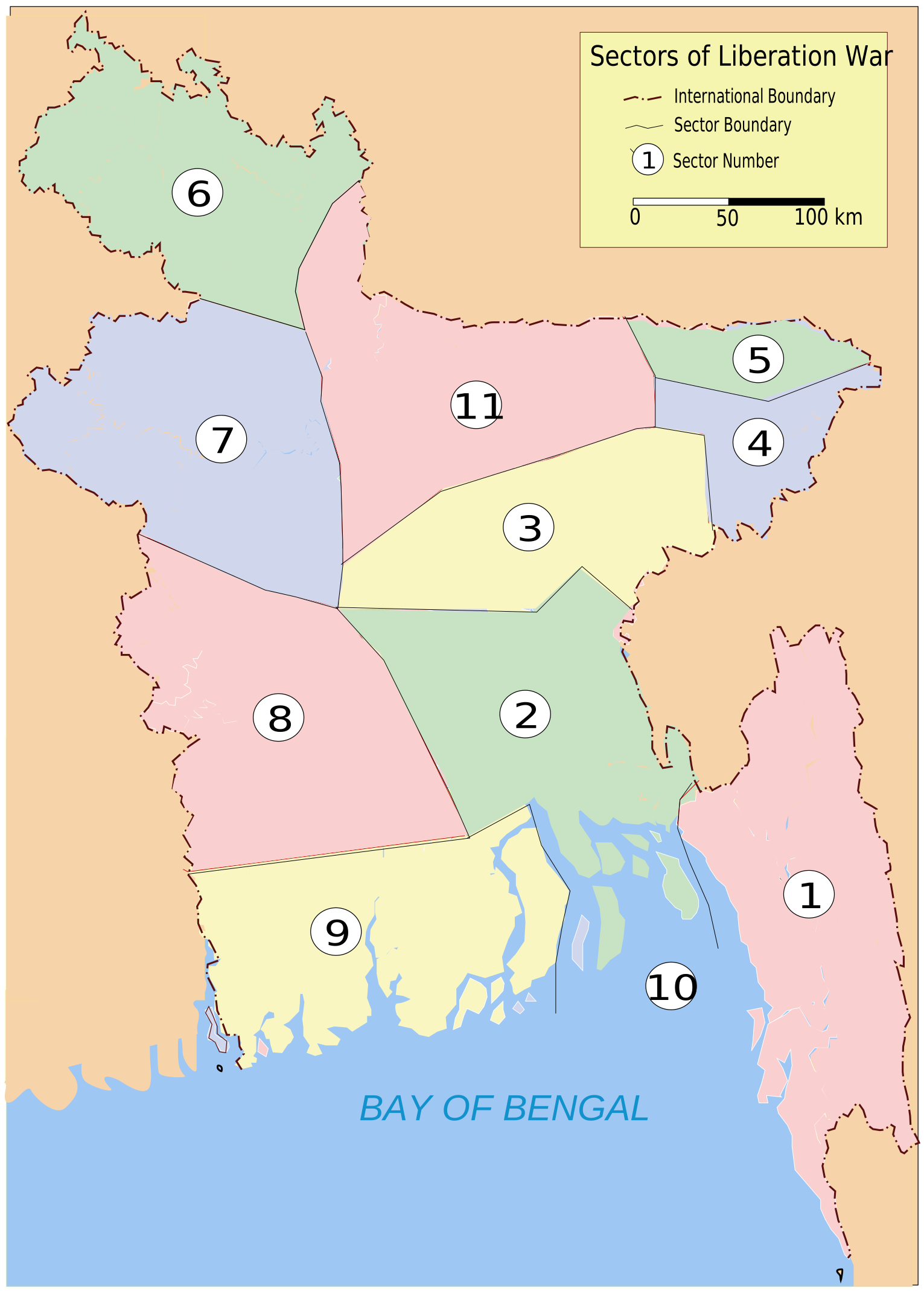
1971 Liberation War: 11 Military Sectors & Sub-Sectors
Definitive war fronts, sector command boundaries and guerrilla operational hubs
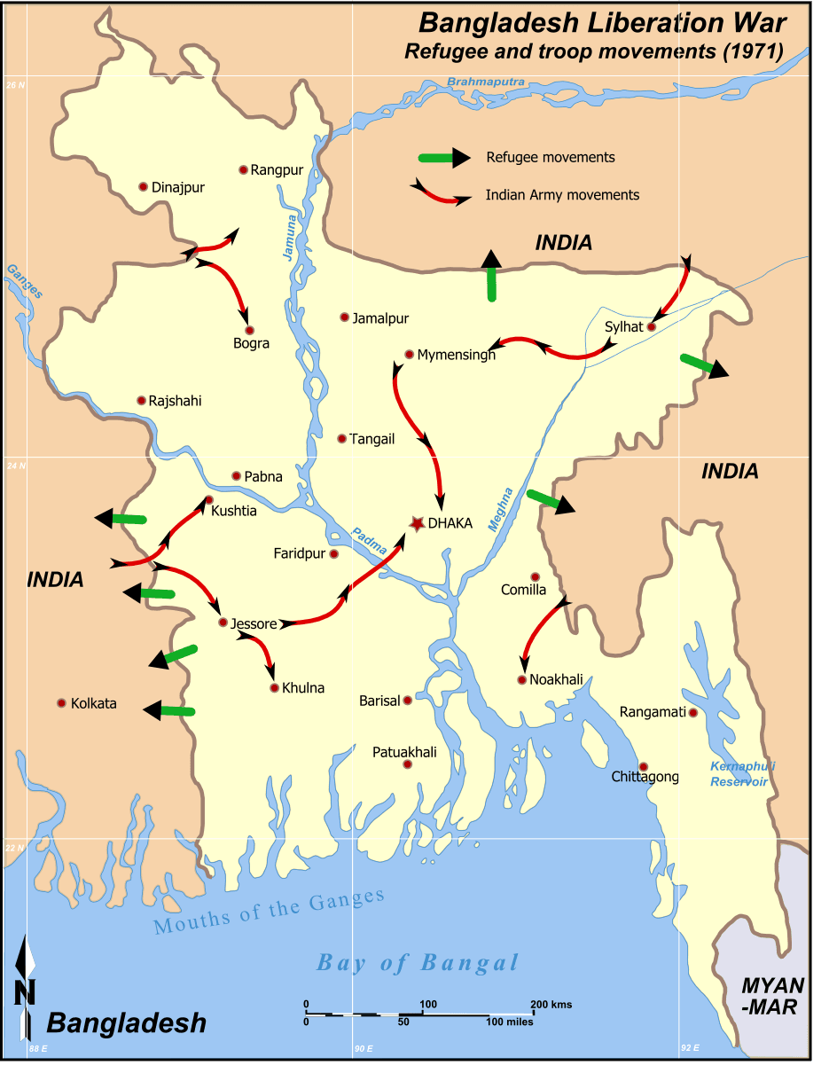
1971 Liberation War: Allied Military Movements & Frontlines
Four-pronged allied thrust into Dhaka and final surrender axes

1776 Major James Rennell: Grand Map of Bengal & Bahar
The monumental first scientific copperplate survey of Bengal & Bihar
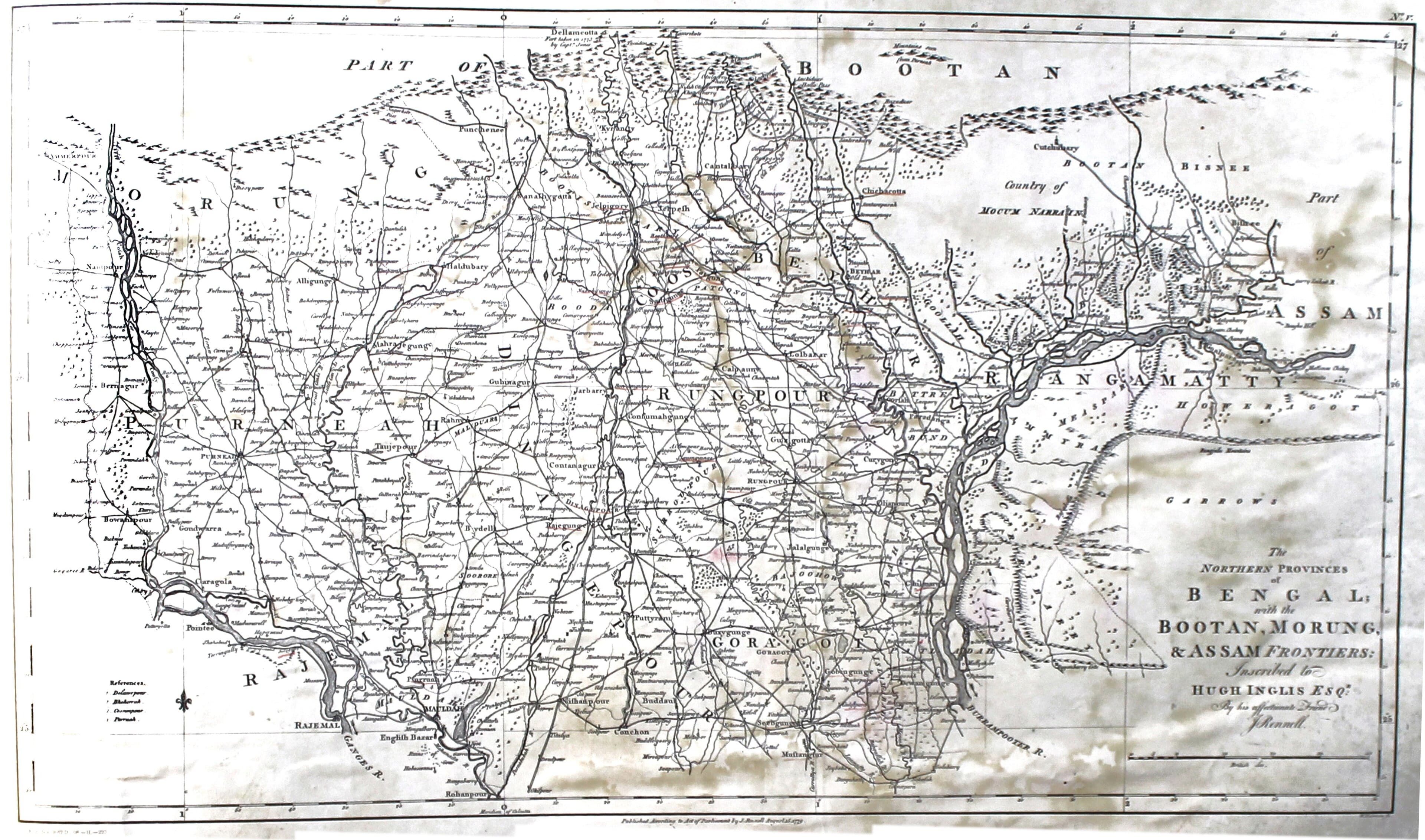
1776 Northern Bengal, Rangpur, Dinajpur, Cooch Behar & Assam
Himalayan foothills, Barind tract, and Teesta basin survey
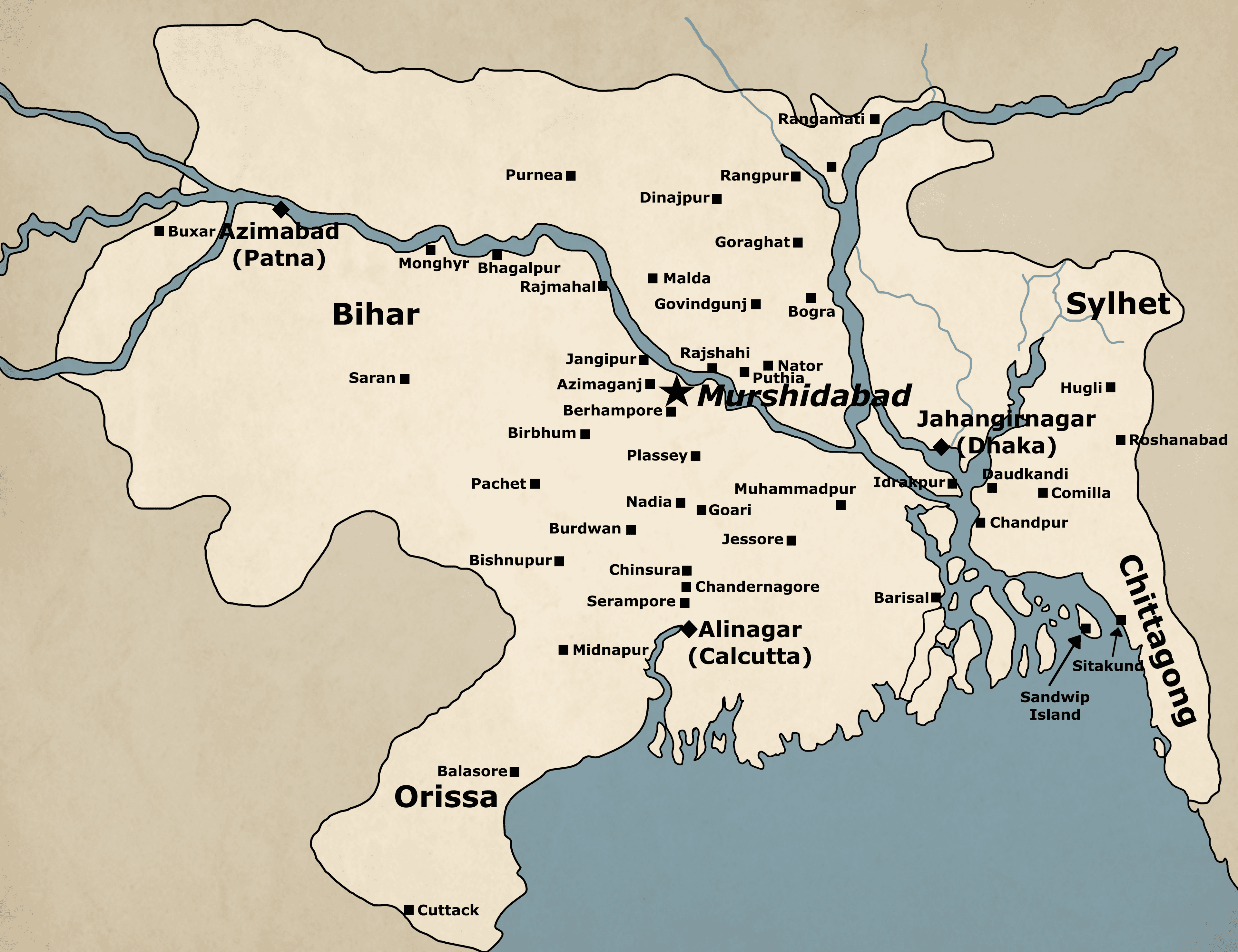
Mughal Subah Bangala: 19 Sarkars, Bhati & Baro-Bhuiyan Frontiers
Administrative geography of Mughal Bengal during Akbar & Jahangir reigns

1875 Survey of India: Eastern Bengal & Deltaic River System
Colonial triangulation survey of the lower delta estuaries and river shifts

1703 John Thornton: Sea Chart of the Ganges & Bay of Bengala
Rare 18th-century nautical chart by royal hydrographer John Thornton
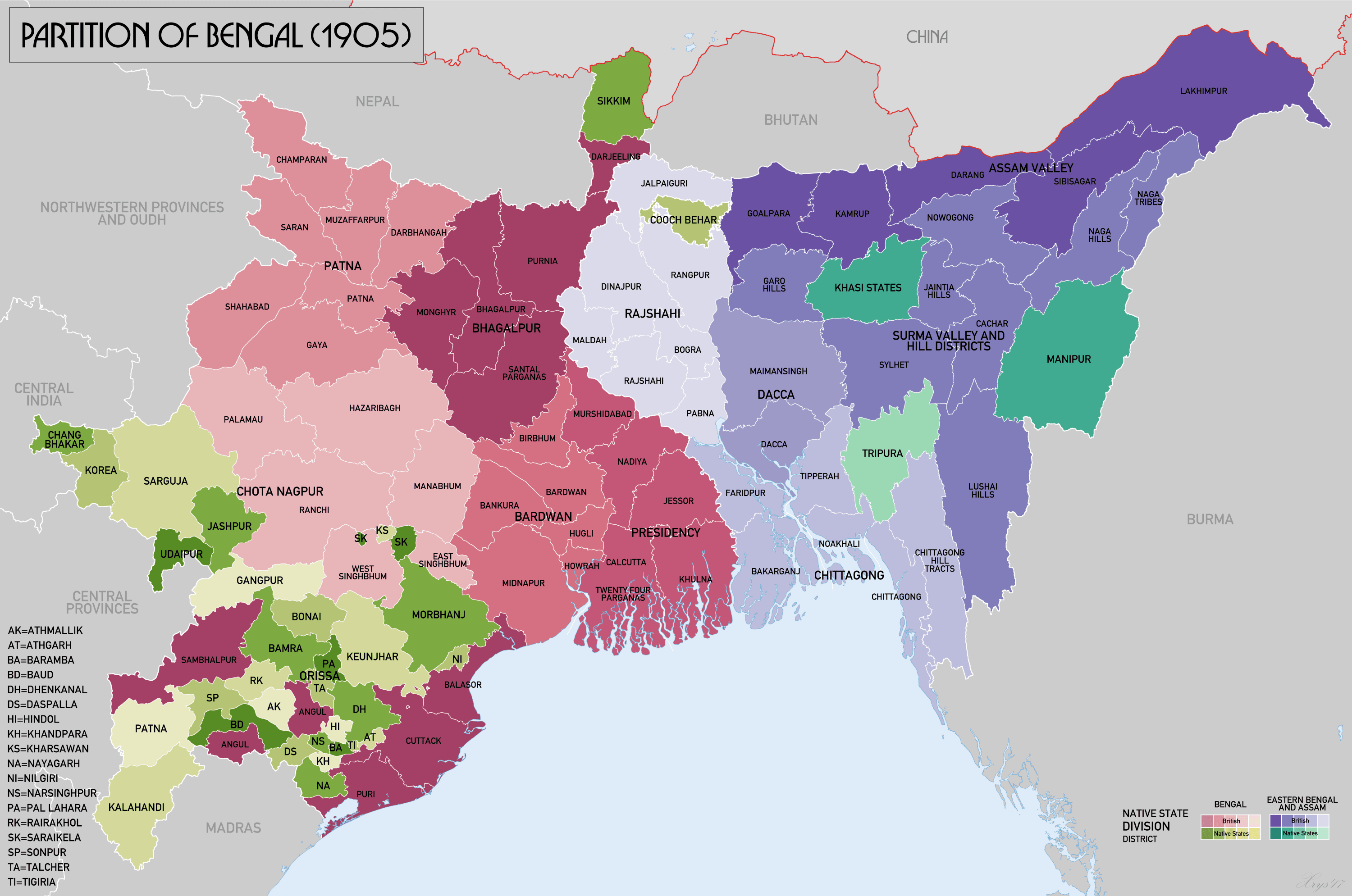
1905 Partition of Bengal: Eastern Bengal & Assam Province
The historic partition delineating the short-lived province with capital Dhaka
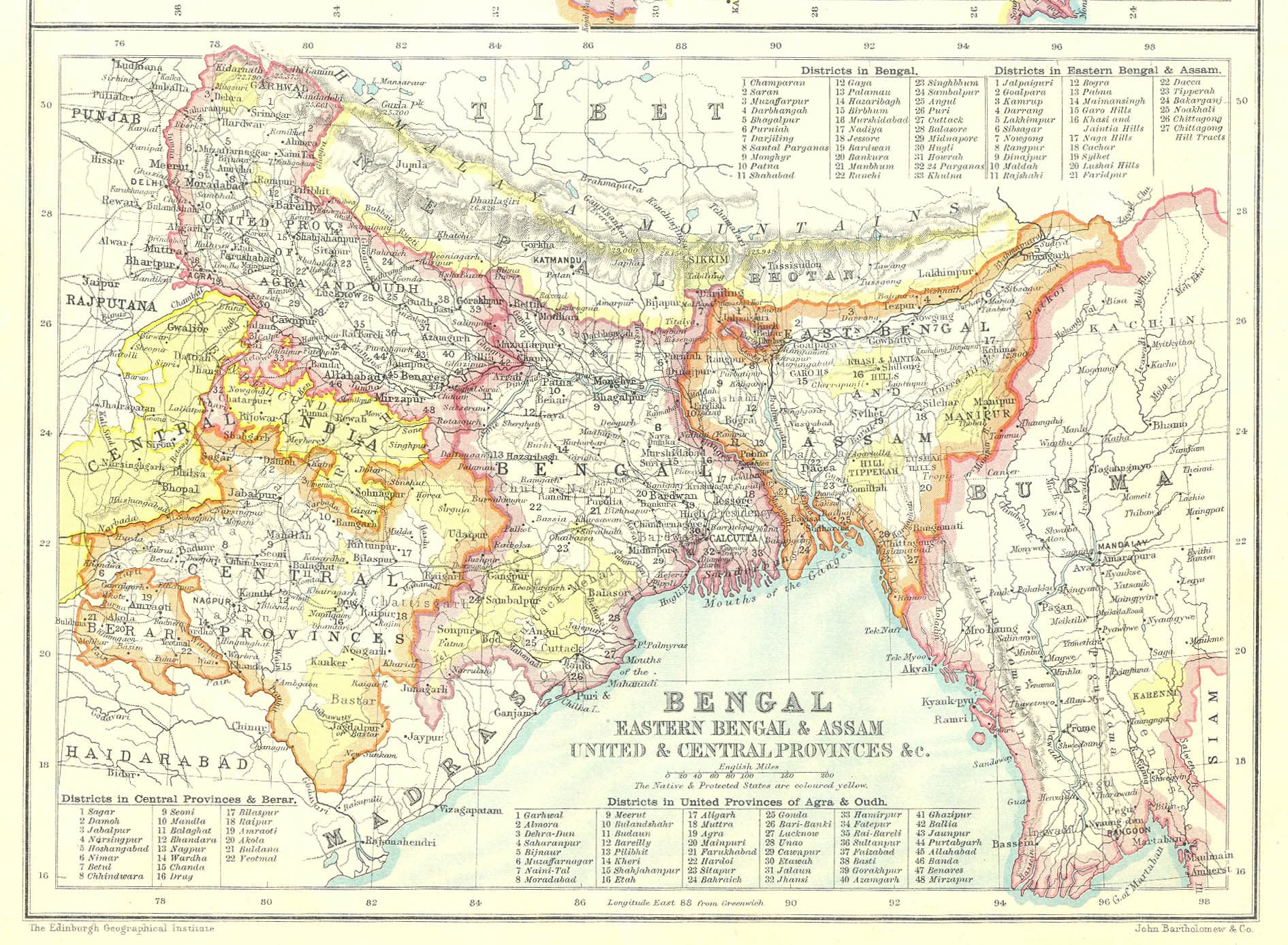
1912 Undivided Bengal Presidency: 5 Administrative Divisions
Unified Bengal Presidency map following the 1911 annulment of partition