

Ancient & Historical Maps of Bengal
A cartographic journey across five centuries — from 18th-century pioneer surveyor James Rennell’s groundbreaking Bengal Atlas to 19th-century riverine navigation charts and boundary maps of the Bengal delta.
10 photographs
Major James Rennell’s monumental 1776 wall map of Bengal and Bihar, the first scientifically surveyed map of the Bengal delta.
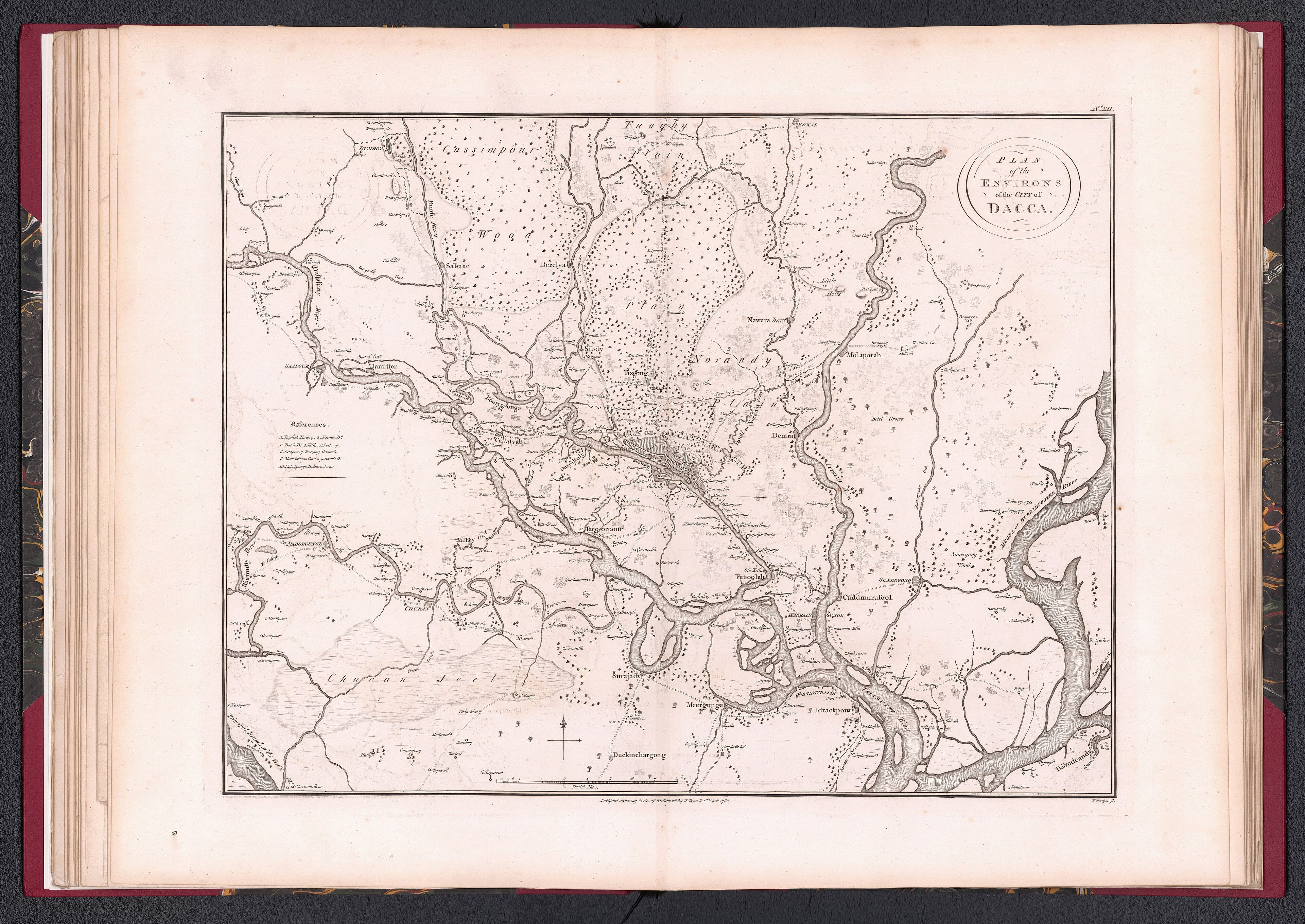
James Rennell’s 1780 "Plan of the Environs of the City of Dacca", detailing the Buriganga, Turag, Balu rivers, Dholai Khal, and historic neighbourhoods.
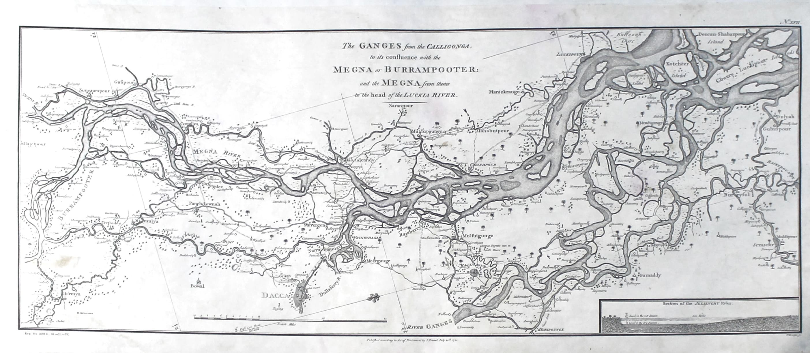
Survey map of the river Ganges from the Kaliganga confluence to the Meghna estuary in 1776, showing the changing channels of the delta.
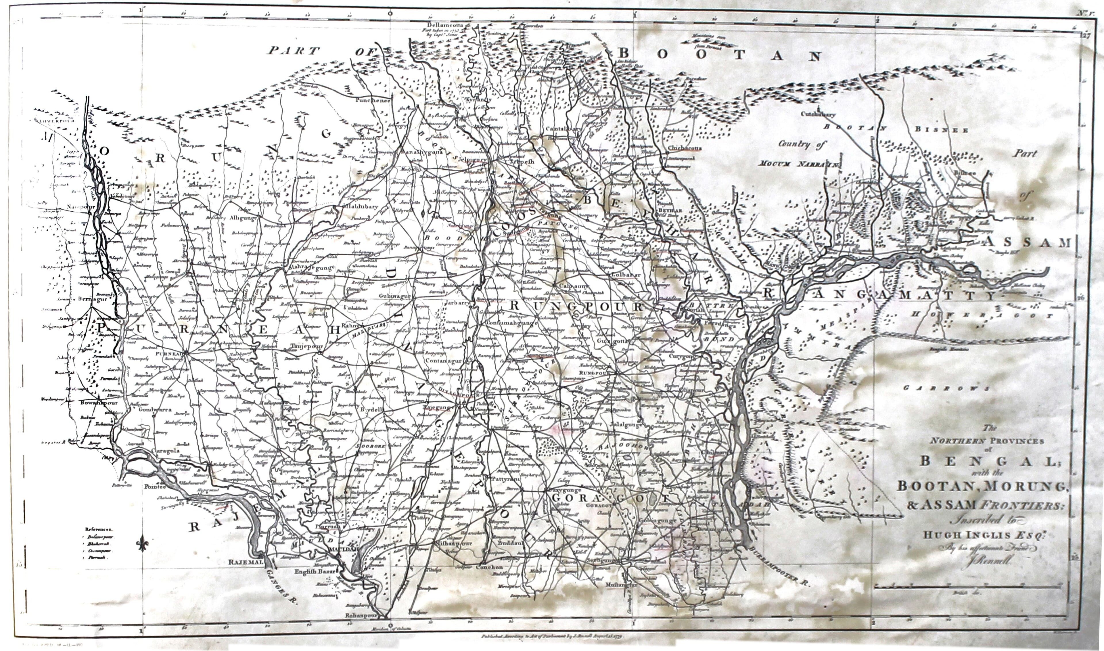
James Rennell’s 1776 survey map of Northern Bengal (Rangpur, Dinajpur, Cooch Behar) bordering Assam and Bhutan.

Samuel Thornton’s early 18th-century nautical chart of the Ganges emptying into the Bay of Bengal, dedicated to the East India Company.

Survey of India 1875 official map of Eastern Bengal, Assam, and Chittagong Hill Tracts, showing railways, telegraph lines, and district boundaries.
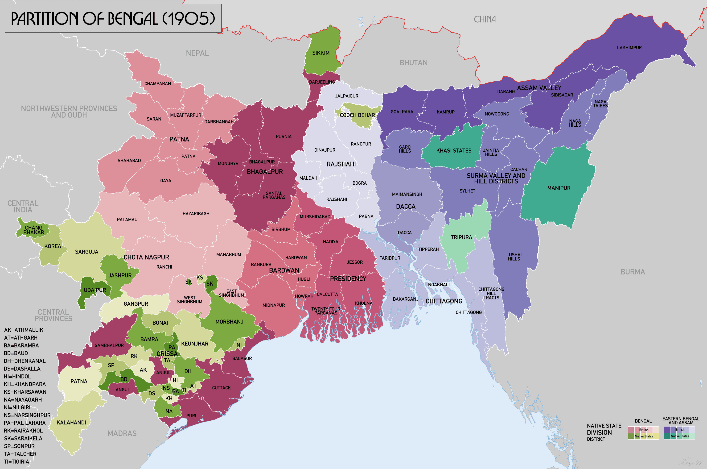
Map illustrating the 1905 Partition of Bengal creating the new province of Eastern Bengal and Assam with Dhaka as capital.
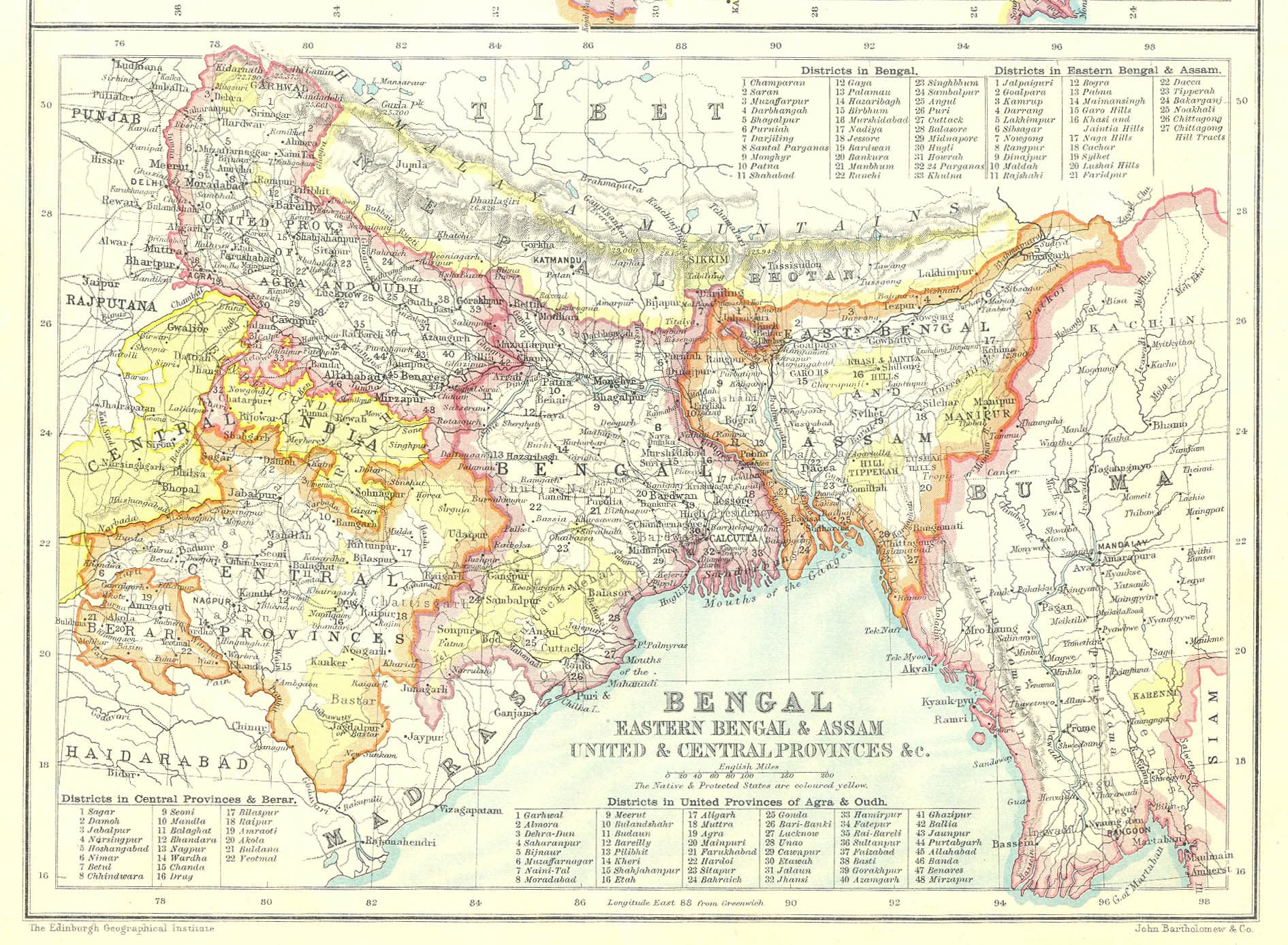
The re-unified Presidency of Fort William in Bengal in 1912 following the annulment of the 1905 partition, by cartographer John Bartholomew.
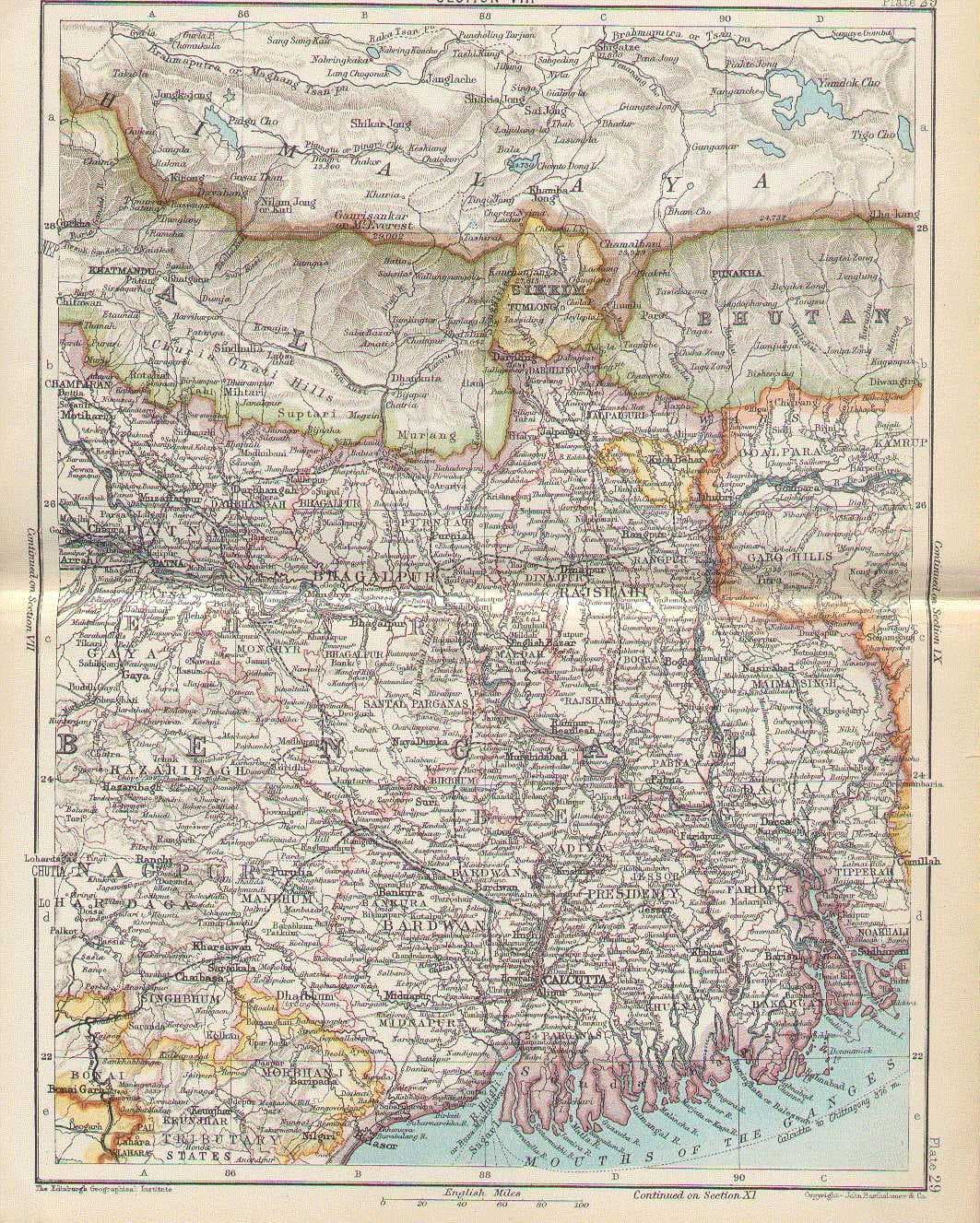
Detailed late 19th-century administrative map of Bengal in 1893, showing divisional headquarters, river paths, and rail arteries.
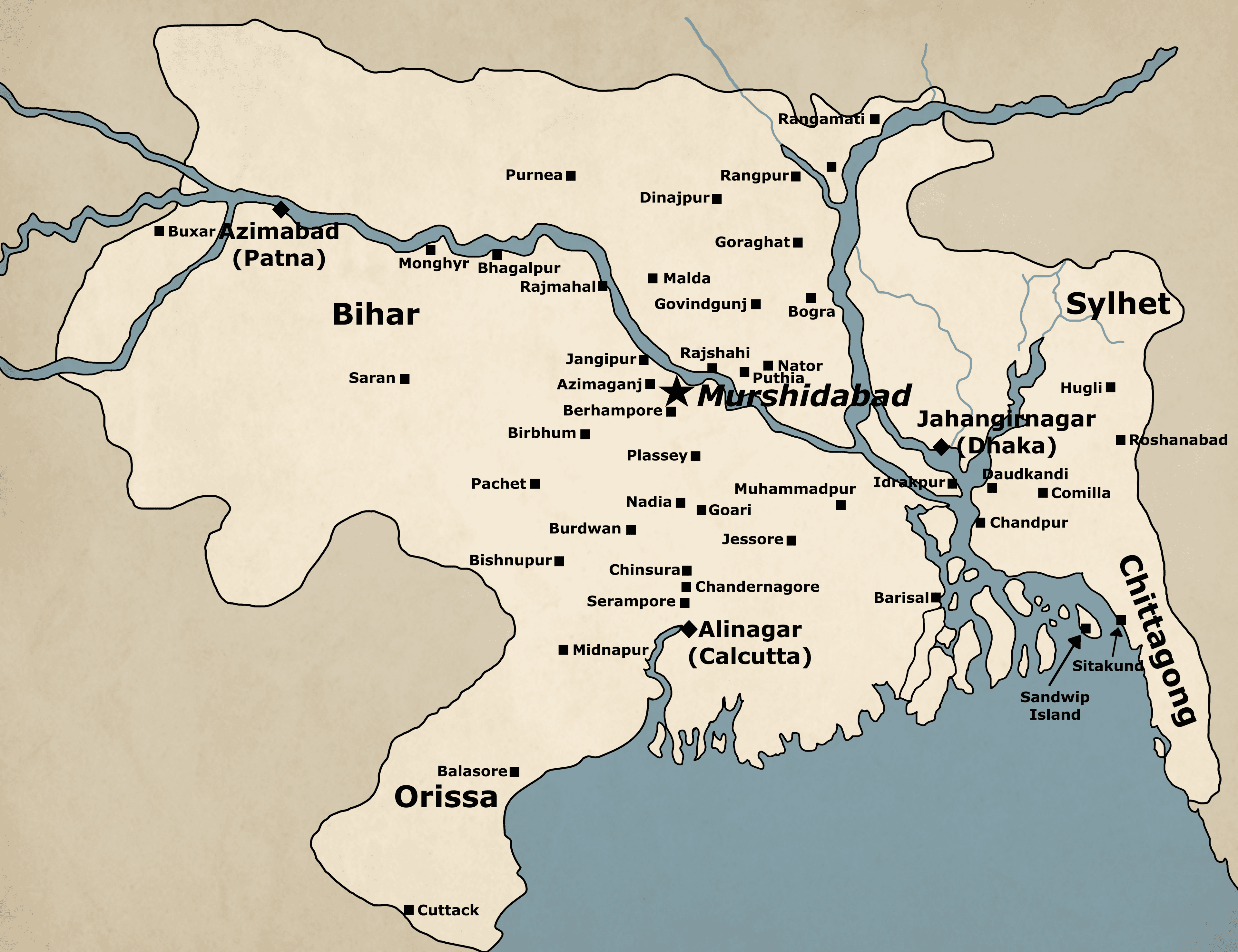
Cartographic representation of Subah Bangalah (Mughal Bengal) showing the sarkars and principal trading cities of the 16th–18th centuries.